Global Remote Sensing Technology Market Size, Share, and COVID-19 Impact Analysis, By Technology (Active Sensing and Passive Sensing), By Application (Agriculture & Living Resources, Military & Intelligence, Disaster Management, Infrastructure, Weather, and Others), By Platform (Satellite and Aerial Systems), and By Region (North America, Europe, Asia-Pacific, Latin America, Middle East, and Africa), Analysis and Forecast 2023 - 2033
Industry: Semiconductors & ElectronicsGlobal Remote Sensing Technology Market Insights Forecasts to 2033
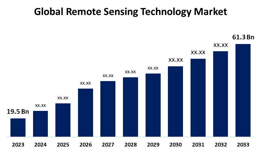
- The Global Remote Sensing Technology Market Size Was Valued at USD 19.5 Billion in 2023
- The Market Size is Growing at a CAGR of 12.1% from 2023 to 2033
- The Worldwide Remote Sensing Technology Market Size is Expected to Reach USD 61.3 Billion by 2033
- Asia Pacific is Expected to Grow the fastest during the forecast period.
Get more details on this report -
The Global Remote Sensing Technology Market Size is Anticipated to Exceed USD 61.3 Billion by 2033, Growing at a CAGR of 12.1% from 2023 to 2033.
Market Overview
The technology used to acquire information about the earth's surface, and its physical properties is known as remote sensing technology. It does not require direct physical contact with the surface area being studied; instead, it makes use of light that is emitted and reflected from satellites and aircraft. The market is primarily driven by the growing number of earth observation projects undertaken by various space agencies. The need for high initial investments in manufacturing numerous components is impeding the growth of the remote sensing technology market. The market players need to manufacture components and encrypt data content that meets the standards set by regulatory organizations. This limits the growth possibilities for companies in the market. Through the emission and reflection of electromagnetic (EM) radiation from the terrestrial, atmospheric, and aquatic ecosystems of the Earth, remote sensing is a geospatial technology that allows for the non-contact detection and monitoring of an area's physical characteristics
Report Coverage
This research report categorizes the market for the global remote sensing technology based on various segments and regions forecasts revenue growth and analyzes trends in each submarket. The report analyses the key growth drivers, opportunities, and challenges influencing the global remote sensing technology market. Recent market developments and competitive strategies such as expansion, product launch, and development, partnership, merger, and acquisition have been included to draw the competitive landscape in the market. The report strategically identifies and profiles the key market players and analyses their core competencies in each sub-segment of the global remote sensing technology market.
Global Remote Sensing Technology Market Report Coverage
| Report Coverage | Details |
|---|---|
| Base Year: | 2023 |
| Market Size in 2023: | USD 19.5 Billion |
| Forecast Period: | 2023 - 2033 |
| Forecast Period CAGR 2023 - 2033 : | 12.1% |
| 2033 Value Projection: | USD 61.3 Billion |
| Historical Data for: | 2019-2022 |
| No. of Pages: | 200 |
| Tables, Charts & Figures: | 115 |
| Segments covered: | By Technology, By Application, By Platform, By Region |
| Companies covered:: | Hexagon AB, Lockheed Martin Corporation., Maxar Technologies, Esri., General Dynamics Mission Systems, Inc., Orbital Insight, Planet Labs PBC., Airbus Defence and Space, BlackSky Global, MDA, L3Harris Technologies, ICEYE, Ball Aerospace, Spire Global, UrtheCast Corporation, and Others |
| Pitfalls & Challenges: | COVID-19 Empact, Challenge, Future, Growth, & Analysis |
Get more details on this report -
Driving Factors
Growing Use of Geographic Information Systems and Remote Sensing in Environmental Risk Management
Remote sensing and GIS technologies are being revolutionized by a new and innovative sensor design. It is employed in the distribution, mapping, and analysis of spatial data. Distance-based remote sensing gathers spatially precise characteristics of the Earth's land and water surfaces from satellite or aircraft images. Environmental variables can be measured by using remote sensing data with different temporal and spatial resolutions. Using GIS, demographics, socioeconomics, and geospatial data from various sources, including remote sensing, are combined to create integrated strategies and solutions. Using sophisticated image processing techniques and algorithms speeds up the process of building a global environment database.
Restraining Factors
Intricate handling of Substantial Amounts of Data
Significant problems include large data volumes and intricately processed, complex data formats. In order to make better use of spatial data, users will probably turn to open GIS data formats and real-time data processing.
Market Segmentation
The global remote sensing technology market share is classified into technology, application, and platform.
- The passive sensing segment is expected to hold the largest share of the global remote sensing technology market during the forecast period.
Based on the technology, the global remote sensing technology market is categorized into active sensing and passive sensing. Among these, the passive sensing segment is expected to hold the largest share of the global remote sensing technology market during the forecast period. Utilizing passive remote sensing technology, one can monitor and analyze surface characteristics by measuring the reflected sunlight from the earth's surface. Because the technology produces high-quality satellite images, it is frequently utilized for a variety of earth observation purposes.
- The military & intelligence segment is expected to grow at the fastest CAGR during the forecast period.
Based on the application, the global remote sensing technology market is categorized into agriculture & living resources, military & intelligence, disaster management, infrastructure, weather, and others. Among these, the military & intelligence segment is expected to grow at the fastest CAGR during the forecast period. This can be linked to the developed world's increasing reliance on technology to keep an eye on and stop harmful and illegal activity. Also, nations like China and Russia are concentrating on employing satellite imagery for defense-related purposes.
- The aerial systems segment is expected to grow at the fastest CAGR during the forecast period.
Based on the platform, the global remote sensing technology market is categorized into satellite and aerial systems. Among these, the aerial systems segment is expected to grow at the fastest CAGR during the forecast period. This can be attributable to the growing use of unmanned aerial vehicles, or UAVs, for aerial mapping. Drone use in surveying fields lowers expenses and speeds up data collection.
Regional Segment Analysis of the Global Remote Sensing Technology Market
- North America (U.S., Canada, Mexico)
- Europe (Germany, France, U.K., Italy, Spain, Rest of Europe)
- Asia-Pacific (China, Japan, India, Rest of APAC)
- South America (Brazil and the Rest of South America)
- The Middle East and Africa (UAE, South Africa, Rest of MEA)
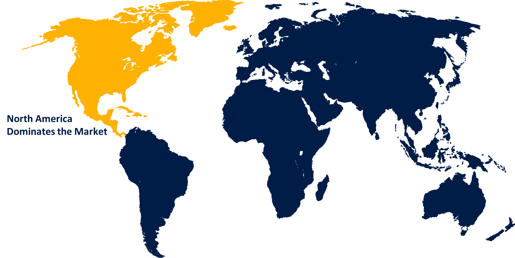
North America is projected to hold the largest share of the global remote sensing technology market over the forecast period.
Get more details on this report -
North America is projected to hold the largest share of the global remote sensing technology market over the forecast period. Major industry participants like Raytheon Technologies Corporation, Esri, General Dynamics Mission Systems, Inc., and Lockheed Martin Corporation are present. It is expected that the market will grow as a result of the precision farming applications' adoption of remote sensing technology.
Asia Pacific is expected to grow at the fastest CAGR growth of the global remote sensing technology market during the forecast period. Due to the growing use of earth observation in applications related to infrastructure development. For companies that provide remote sensing technology, nations like China, Japan, Australia, and India are thought to be the most lucrative markets in the area.
Competitive Analysis:
The report offers the appropriate analysis of the key organizations/companies involved within the global remote sensing technology market along with a comparative evaluation primarily based on their product offering, business overviews, geographic presence, enterprise strategies, segment market share, and SWOT analysis. The report also provides an elaborative analysis focusing on the current news and developments of the companies, which includes product development, innovations, joint ventures, partnerships, mergers & acquisitions, strategic alliances, and others. This allows for the evaluation of the overall competition within the market.
List of Key Companies
- Hexagon AB
- Lockheed Martin Corporation.
- Maxar Technologies
- Esri.
- General Dynamics Mission Systems, Inc.
- Orbital Insight
- Planet Labs PBC.
- Airbus Defence and Space
- BlackSky Global
- MDA
- L3Harris Technologies
- ICEYE
- Ball Aerospace
- Spire Global
- UrtheCast Corporation
- Others
Key Market Developments
- In July 2023, Hexagon acquires HARD-LINE and strengthens mine safety, automation, and underground offering with tele-remote technology.
- In January 2023, the medium-sized Lockheed Martin LM 400 satellite, which can be used for military, commercial, or civil applications, was introduced by Lockheed Martin Corporation. Platforms supporting radar, sensing, imaging, remote communications, and persistent surveillance are made possible by the LM 400 spacecraft bus design.
Key Target Audience
- Market Players
- Investors
- End-users
- Government Authorities
- Consulting And Research Firm
- Venture capitalists
- Value-Added Resellers (VARs)
Market Segment
This study forecasts revenue at global, regional, and country levels from 2020 to 2033. Spherical Insights has segmented the global remote sensing technology market based on the below-mentioned segments:
Global Remote Sensing Technology Market, By Technology
- Active Sensing
- Passive Sensing
Global Remote Sensing Technology Market, By Application
- Agriculture & Living Resources
- Military & Intelligence
- Disaster Management
- Infrastructure
- Weather
- Others
Global Remote Sensing Technology Market, By Platform
- Satellite
- Aerial Systems
Global Remote Sensing Technology Market, By Regional
- North America
- US
- Canada
- Mexico
- Europe
- Germany
- UK
- France
- Italy
- Spain
- Russia
- Rest of Europe
- Asia Pacific
- China
- Japan
- India
- South Korea
- Australia
- Rest of Asia Pacific
- South America
- Brazil
- Argentina
- Rest of South America
- Middle East & Africa
- UAE
- Saudi Arabia
- Qatar
- South Africa
- Rest of the Middle East & Africa
Frequently Asked Questions (FAQ)
-
1.What is the CAGR of the global remote sensing technology market over the forecast period?The Global Remote Sensing Technology Market Size is Expected to Grow from USD 19.5 Billion in 2023 to USD 61.3 Billion by 2033, at a CAGR of 12.1% during the forecast period 2023-2033.
-
2.Which region is expected to hold the highest share in the global remote sensing technology market?North America is projected to hold the largest share of the global remote sensing technology market over the forecast period.
-
3.Who are the top key players in the remote sensing technology market?The top key players in the global remote sensing technology market are Hexagon AB, Lockheed Martin Corporation., Maxar Technologies, Esri., General Dynamics Mission Systems, Inc., Orbital Insight, Planet Labs PBC., Airbus Defence and Space, BlackSky Global, MDA, L3Harris Technologies, ICEYE, Ball Aerospace, Spire Global, UrtheCast Corporation, and Others.
Need help to buy this report?